Lead by Hoyt Nelson
>>> ERRATUM – NOTE contact email address has been revised- see end of article <<<
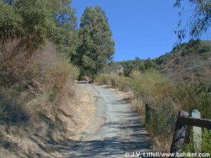
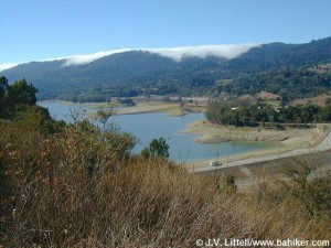
Great views of Lexington Reservoir to the west at the start and a sweeping view of the Santa Clara Valley to the east at the top. There will still be monkey flowers, Scotch broom and remnants from the vineyards that supplied sacramental wine for the Novitiate in Los Gatos many years ago.
Take Hwy 17 South just past Los Gatos and exit at Bear Creek Road (Lexington Reservoir on your left) so you can go left and double back on the other side of 17 on Alma Bridge. Continue across the dam spillway to a parking lot on the right. There is a $4 parking fee and you may get a ticket if you park along the road to avoid this so carpooling is suggested. (We can meet at my place at 9:30). We meet in the parking lot at 10 AM where the hike begins just a few feet further on the left up the hill.
I have done this hike 3 or 4 times, but can’t find any my pix, so I attached a few from http://www.bahiker.com. This is a great detailed source of hiking information in the Bay Area – 60 hikes that are roughly as far south as Santa Cruz/Gilroy to about Healdsburg to the north and to Brentwood in the east. It’s easy to navigate and includes exhaustive lists of related information.
The hike is a little over 3 miles round trip on a semi-loop dirt trail with about 650 ft. of elevation change. We should be done by noon. Not too much shade, so bring a hat, sunscreen, drinks, and layer your clothing. Also bring camera, snacks and wear sturdy foot. There is a porta-potty but no water in the parking lot.
I can suggest lots of spots for lunch nearby or you can bring your own.
Contact Hoyt at StJosephsHill@niseiskiclub.org to sign up and get more information.
>>> NOTE – revised email address <<<


